Tag: QGIS
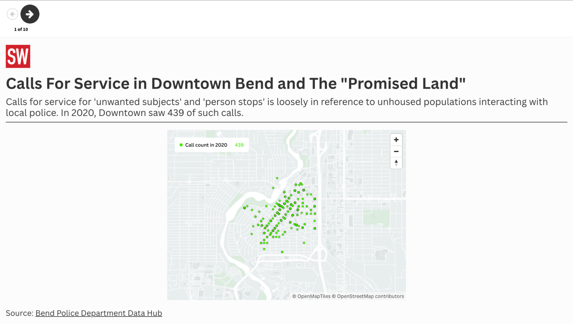
Fact checking police claims about crime with data maps
Identifying the influx of one local police department’s calls for service.
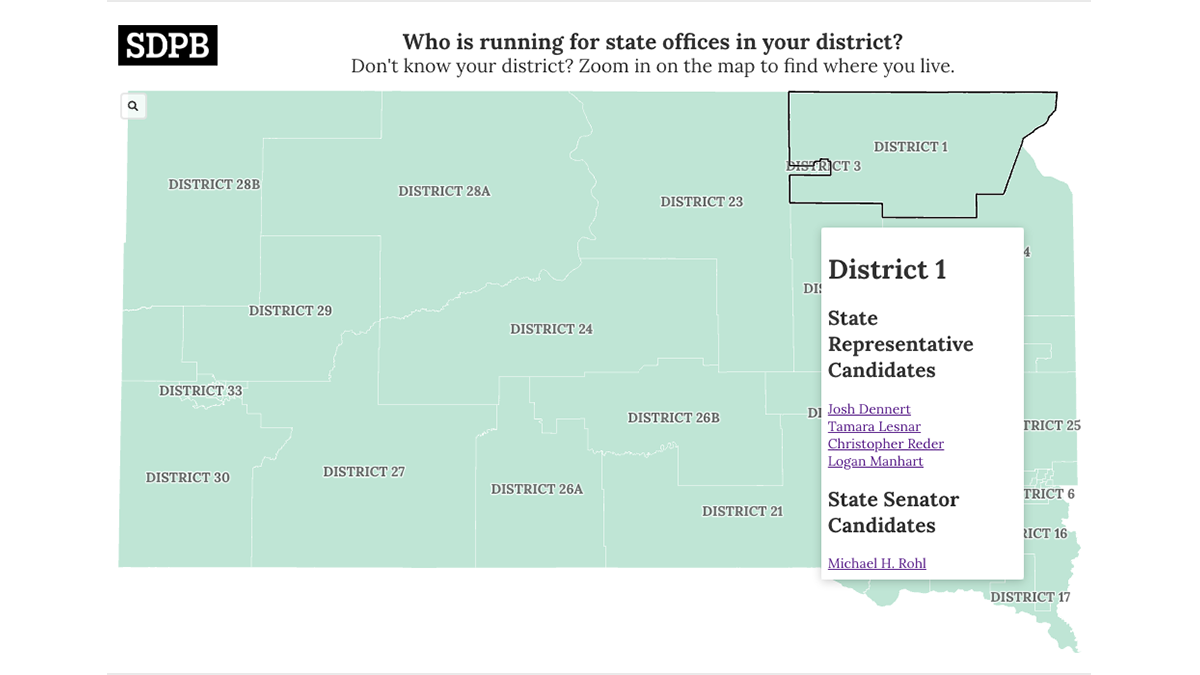
How we built a statewide election map
A simple, no-code solution to sharing voting information and four additional tools for your newsroom election projects.
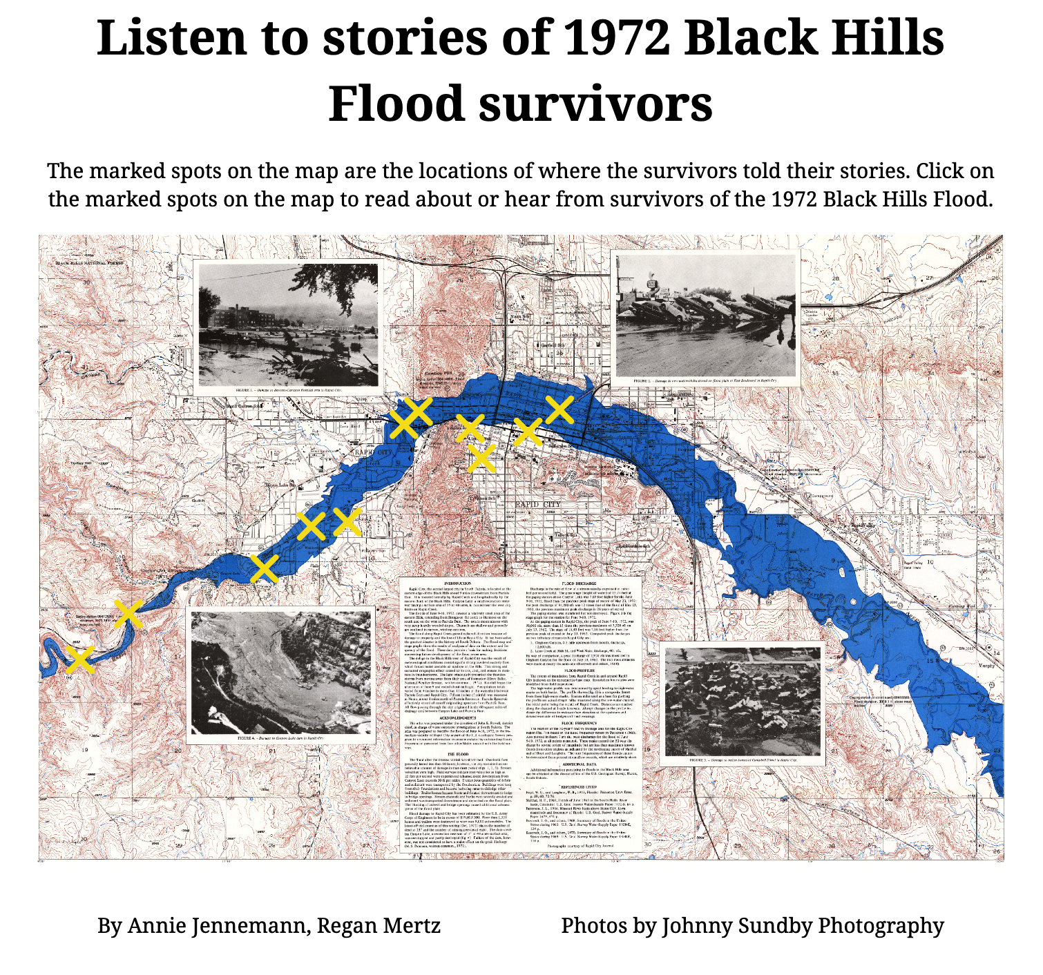
Combining historical and current day journalism in an interactive experience
South Dakota Public Broadcasting used archival maps, audio stories, photos and other content to combine reporting on survivors’ stories